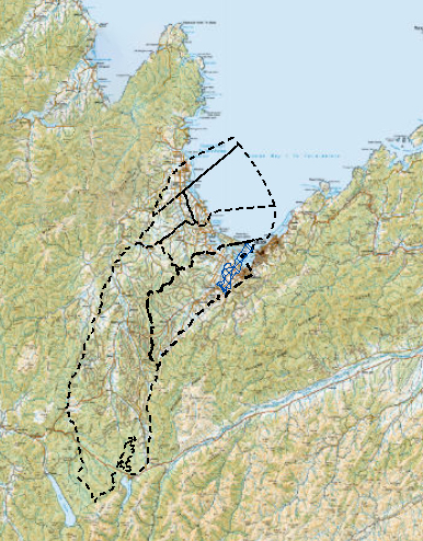
The Deep Moutere Aquifers underlies the Moutere valley and hill country and the Waimea Plains, extending towards Nelson Lakes National Park past the Upper Motueka Water Management Zone, and out under the coastline.
The aquifer is up to 1000 metres deep and resides in layers within the Moutere gravel which overlies the Moutere Depression. The aquifer is not connected to overlying land use or rivers, so is largely confined, and groundwater quality is variable depending on depth and location.
The deeper water in these aquifers is very old – 400 to 20,000 years. Although there is some rainfall recharge, this can be very slow in most areas, meaning water recharge capacity is low. Abstraction levels, depending on drought conditions, will affect recovery of aquifer levels. After a very dry year the aquifers may take more than one season to recover. Some areas of the aquifer are nearly fully allocated, with minimal additional capacity.
Note: text in italics shows the sections of the vision specific to this FMU.
It is 2100, our waterbodies are healthy, connected and resilient where indigenous ecosystems and biodiversity are thriving. People have access to water for use within the natural characteristics and limits of the aquifer.
It is 2035, our land and freshwater management provides for our community’s social, economic and cultural wellbeing. People have access to safe, clean water for drinking.
It is 2040, sustainable and integrated land and water management practices protect the ecosystem health and natural character and pressure of our aquifers, and provides for our agriculture, commercial and industry sectors.
It is 2055, our communities and livelihoods are resilient to our changing climate and drought hazards and our food producing areas continue to play an important role for local food security.
We all respect and take responsibility for freshwater health. We value the taonga we are protecting. Through collaboration and innovation we have adapted to new ways of doing things. We have protected and maintained the quality and quantity of freshwater, enabling sustainable use for generations to come.
| Value Type | Values applying in FMU | Values not applying in FMU |
|---|---|---|
|
Compulsory National Values |
|
|
|
Other National Values |
|
|
|
Other Community Values |
|
|
The key freshwater challenges are:
The Moutere Depression is the defining geology within which the deep aquifers under the Moutere and Waimea reside. This depression is about 23 km wide and extends 65 km from the headwaters of the Motueka River Catchment to Te Tai o Aorere / Tasman Bay. It was formed during the uplift of the Tasman Mountains southeast of the Alpine fault.
A high southern underground basement rock ridge runs through from about Neudorf to Ruby Bay. The basement drops sharply to the east towards Richmond. A major fault line also separates eastern and western aquifers in the Moutere valley.
Voluminous gravels from 1 – 2 million years ago are preserved in the Moutere Depression and reach over 600 metres deep under the Moutere Valley, and up to 1000 metres deep towards Richmond. This gravel is delineated by clay layers into three main units – basal, middle and upper which creates three levels of aquifer. More compact, cleaner gravels are deeper.
There are two main aquifers – the Deep Moutere Aquifer and the Waimea Deep Moutere Aquifer. The Deep Moutere Aquifer is divided into three different aquifers – the deep, middle and shallow Moutere Aquifer. These aquifers are internally leaky in that water can travel between them. However, the shallow aquifer is largely confined at the surface by reworked valley infilling.
The Waimea Deep Moutere Aquifer extends under Richmond and the Waimea Plains and out beyond Moturoa/Rabbit Island in the north, to near the source of the Wai-iti River in the south, and includes the western portion of the Moutere Hills.
The aquifers are recharged from very slow rainfall infiltration in the western margins of the Moutere and from fault zones around the Waimea and Motueka valley areas where Moutere Gravels outcrop. The water is very old with a range of 400 - 20,000 years residence time with age generally increasing with depth. The old deep water from the deepest of the aquifers is believed to have been recharged during the last glaciation.
The deep Moutere Aquifer also extends past Upper Motueka towards Nelson lakes. Not much is known about groundwater here as there is very limited deep drilling information. The few deep bores show very limited yields and in cases no useable yields.
The regularly monitored bores in the Deep Moutere Aquifers show no evidence of human influence on their groundwater quality. This is because the aquifers are largely confined at the surface. Water quality is therefore very good and has very low risk of contamination.
The aquifers typically have higher total dissolved solid concentrations compared to the other monitored Tasman groundwaters because they are held for a very long time within a thick sequence of clay bound gravels, resulting in a greater degree of groundwater/rock interaction.
Because water is old, these groundwaters are also typically depleted of dissolved oxygen (i.e. anaerobic) which is reflected by elevated iron and manganese, and to a lesser extent, ammonium concentrations coupled with low nitrate concentrations.
There are limited takes from these aquifers because of the slow rainfall recharge and the water’s age. Only small allocations are available from these aquifers primarily in the Moutere FMU, and typically takes are where there are no alternative water supplies. Water abstraction is mainly from deep bores between 100-600m deep, with the deepest over 800m. This is both due to cost and poor flow availability from many of these deep sources. Deep groundwater zones are fully subscribed and there is a waiting list to access deep Moutere aquifer groundwater.
Current water take management triggers for irrigation are designed to protect the physical nature of the aquifers. Limits are set based on the irrigation season covering 180 days per year. Long term pumping causes large drawdown effects.
Some areas are free flowing artesian. Groundwater yields improve significantly with depth, and heads are generally higher at depth. Yields are also better to the north and north west from Ruby Bay.
Last modified: